Dave left Plymouth at 10 am, calling in on Exeter to pick up Rich and to travel to Heathrow.
They fly over night to Kathmandu. follow their adventure on Dave's blog which can be accessed through the virginmoneygiving.com website ( link on this blog)
So my work is done, Bob and I must be fitter as a result!! Bob certainly has a waist now!
Through this blog, I have recorded 41 walks all around Devon, Cornwall and Somerset, depending on where we were. We have been so lucky with the weather and there are only a couple of walks that were hard on the mind as well as the body!!
I still feel there are many places we have to explore when Dave returns. We seem to have started something here!!! I would like to explore Haldon Hill, Dawlish, Dartmoor, the coast walks etc etc. so do please keep looking at my blog. I am blogging for Devon Life too, where I put a precise of one of these walks each week.
So do have a look through this catalogue of training walks and let me know which ones you have enjoyed!!
Teresa x
My blog started out as a diary to encourage us to take more exercise! The more we walk, the more there is to see! so this blog will hopefully inspire others to get out there and enjoy all that Devon has to offer, whether on Dartmoor or by the coast. Scroll down to see older blogs as they are in chronological order. Devon is a beautiful county and I hope you can see that from my photographs. Please add your comments. Teresa
Friday, 11 February 2011
Sunday, 6 February 2011
Staplehay - Pitminster - Blagdon Hills Sunday 6th February 2011
Saturday, 5 February 2011
Cadover Bridge - Trowlesworthy - Saturday 5th February 2011
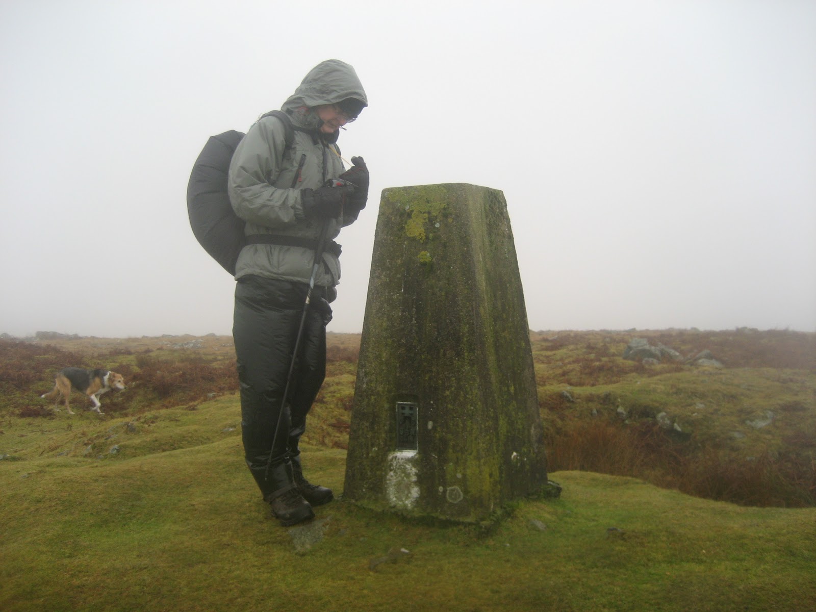
6 days to go and it's raining!! Dave and I agree this must have been the worst walk we have been on in all the time we have been recording these walks. The wind was howling like a jet plane, the rain was soaking us, the mist made it impossible to see very far, we lost our way twice and ended up walking a couple more miles than we intended. However, on the plus side umm what plus side??? oh, yes, Dave did some more exercise and he can always think when he is climbing towards Base Camp, that nothing will be as bad as this walk!!!
We were the second car in the car park at Cadover Bridge which shows you how bad the weather was. In summer, this car park is full and with an ice cream van tempting us.
Just in case you didn't quite understand the conditions on the moor, please have a look at the video below.
Walking away from the Tor, eventually we come to a small stone circle
This is where it started to go wrong! We turned left instead of right and walked for a mile along difficult boggy terrain. The view of the clayworks (below) was spectacular though.
Back tracking and now on the correct path, the sluice bridge over a deep river took us towards Big Pond
The guide book didn't help, as the path was shown on the other side of the Pond. tut tut
Across the moors, heading towards the Trig point
The guide book then let us down, as the instructions were to head towards the church spire in the distance!!
No compass bearings to help us. We walked and walked and passed this stone structure before emerging on the Wotter road, a mile away from Cadover Bridge
So we walked 8 miles instead of 6! and no ice cream van either!! More cars though in the car park. It was 3 o'clock by now. Our wet weather gear has been well and truly tested!! I suppose normal people wouldn't even consider attempting this walk in this weather, so we only have ourselves to blame!!
We were the second car in the car park at Cadover Bridge which shows you how bad the weather was. In summer, this car park is full and with an ice cream van tempting us.
| Cadover Bridge |
| Blackabrook joins the River Plym |
| National Trust property |
| Trowlesworthy Warren |
| This is either Little Trowlesworthy Tor or Great Trowlesworthy Tor ??? |
| Even as we get closer, we are still not sure?? |
Walking away from the Tor, eventually we come to a small stone circle
| Lost in a stone circle. I see no ships!!! |
| This was the stone row we think. A bit disappointing after the Drizzlecombe one! |
| China Clay pit |
| The sluice bridge and warning signs of deep water. Take a right towards Big Pond. |
| Big Pond |
| Blackaton Cross |
| Entrance to Lee Moor Quarry |
| The quarry workings on the horizon |
| At last, the trig point |
No compass bearings to help us. We walked and walked and passed this stone structure before emerging on the Wotter road, a mile away from Cadover Bridge
| This was the cross we should have aimed for. |
| Back to Cadover Bridge |
Saturday, 29 January 2011
Dittisham to Dartmouth circular walk - Saturday 29th January 2011
Not long to go now!!! The local paper has run an article on the challenge this week, so the pressure is really on !!! Dave has wanted to do this walk for a while, and I have cried off until now. I have run out of excuses, so here it is!!
Dave, Teresa and Bob set off from Dittisham up through the village towards Dartmouth on the Dart Valley Trail. Very cold but dry. Dart means Oak and the banks of the river are lined with oaks. We also walked through a pine forest.
From here, we had to climb a very steep road out of the valley and at last we came into Dartmouth
After a pork bap and hot chocolate we caught the ferry across to Kingswear
The National Trust property was closed and we were concerned that the ferry at the bottom of the hill would not be there! After this long walk, my knees were complaining a bit!
This is the longest walk we have done. 10 miles! It didn't seem too bad as we had lunch at Dartmouth. We will suffer from it tomorrow. Started at 11 and were back by 4 30. This was probably the best type of walk for this weather as we were protected by the woods, and although it was cold, we were warm from the steep climbs. Although they were tough, neither Dave or I were puffed at the end of them. Bob, too, seems much fitter these days.
Dave, Teresa and Bob set off from Dittisham up through the village towards Dartmouth on the Dart Valley Trail. Very cold but dry. Dart means Oak and the banks of the river are lined with oaks. We also walked through a pine forest.
![]() |
| Starting point at the village of Dittisham |
| From Dittisham we headed uphill |
| Over lands that belonged to Sir Walter Raleigh |
| We can spy Dartmouth tantilising us in the distance |
| Looks like we are nearly there! |
| Badger setts were all along this route |
| Dartmouth must be around this corner.... |
| Mill End Creek |
| At the top of Dartmouth |
![]() |
| Cobbled streets of Dartmouth . ( I am not really that fat, I have at least 5 layers of clothing on! T) |
| Dartmouth |
| KIngswear approaching; we were the only passengers on the ferry |
| KIngswear looking towards Dartmouth |
| The path continued beside the railway track |
| Long Wood. where we had several steep climbs back to the top of the hill |
| At last arriving at Greenway, once the home of Agatha Christie |
| View of the River Dart from Greenway |
| Dittisham from Greenway |
| YES -The ferry was there, a minute later we were back in Dittisham |
| Back on dry land at Dittisham |
Sunday, 23 January 2011
Giant's Basin and Eylesbarrow tin mine - Sunday 23rd January 2011
19 Days to go before Everest, 500 training miles covered so far.
| The Scout Hut |
| Gutter Tor from the scout hut |
| Gutter Tor, Sheeps Tor and the conifers surrounding the scout hut |
![]() |
| These cattle blocked our way along Edward's path |
![]() |
| Looking back the way we came on Edward's path |
| Ditsworthy Warren House next to Eastern Tor |
| In the distance we could see the stone row and loads of backpacking teenagers. |
| The first standing stone of the stone row at Drizzlecombe |
| Drizzlecombe |
![]() |
| Giant's Basin with the tallest standing stone on Dartmoor to the right |
| The tallest standing stone on Dartmoor. ( 14 ') Dave looks quite short in comparison! |
| Kistvaen |
Further on we crossed a small stream and picked up a track direct to the Eylesbarrow ruin at the top of the hill.
| Eylesbarrow Tin mine |
![]() |
| Teresa fighting her way through the marsh ( and complaining a lot!!!) |
| Combshead Tor with Burrator Reservoir in the distance |
| From Combeshead Tor you can see the mast at North Hessary Tor. | ( you might want to click on this to enlarge the picture to see it!!) |
| Combeshead Tor |
| Cuckoo rock |
| Deanscombe |
What a lovely day! and to think its still January!
(View of Burrator as we approached the start of the walk was breathtaking!)
| On the way to the scout hut, we had to stop to admire this view |
Subscribe to:
Posts (Atom)