Monday, 20 February 2012

Talland Bay to Polperro - Sunday 20th February 2012

Again, apologies for being in Cornwall this weekend, but we decided to continue another piece of the South West Coastal Path and picked it up from Talland Bay ( see blog for 4th September 2011).

Just around the corner where we stopped last time, is Talland Bay proper.  The colours of the rocks are pink and blue.  From here, the path becomes quite steep and then levels off .  The path is well defined and half way to Polperro is a war memorial and a seat.  Polperro was very quiet and beautiful.  A cornish pasty for lunch and eaten on a bench overlooking the sea on a sunny day such as this, is my perfect sunday!

Here are a few photos of the walk:

The blue and pink rocks of Talland Bay
Talland Bay from the footpath

War memorial to Looe and Polperro men who fell in the war
Polperro almost in sight

Polperro A new sewage treatment works has been completed  
If you are fit and can climb hills, these seats command a lovely view of the harbour!
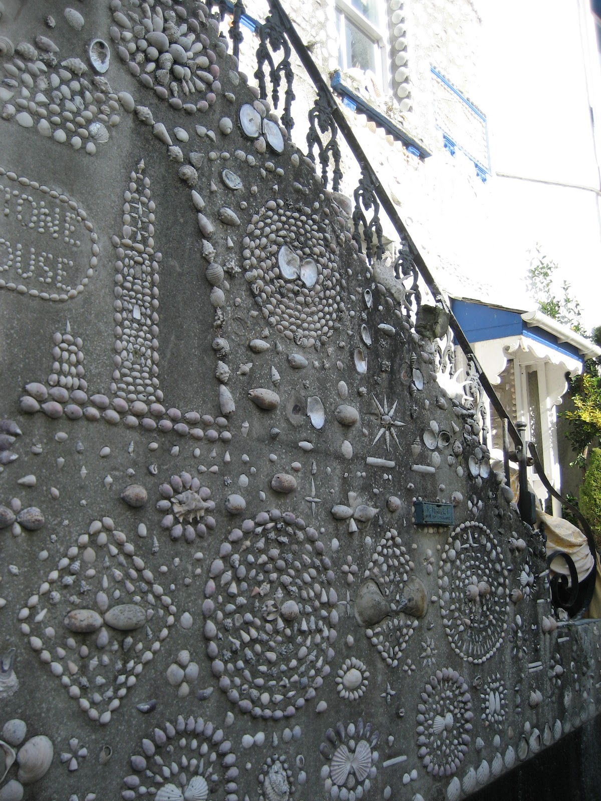
The shell house, Polperro
The Harbour


Back to Talland Bay
Bob in front of Aesop's Bed, Talland Bay

Sunday, 12 February 2012

Jennicliffe to Bovisand - Sunday 12th February 2012

This walk has spectacular views of Plymouth Sound, The Rame Peninsula, The Breakwater and Bovisand.  The footpath immediately from Jennicliffe has been cordoned off at the moment, so we drove up the hill a little way to a small space for 2 cars opposite the footpath. Much evidence of fortifications along this walk

From here, through a wood and over a stream which marks the boundary between Devon and South Hams, the path skirts the coast and reveals a fantastic view of Plymouth.

A little misty, but clear nevertheless!

Plymouth Breakwater designed by John Rennie and commenced in 1811.  4,000,000 tons of stone later, it was completed in 1842.  It is one mile long and on a clear day you can see Eddystone Lighthouse and the stump of the original Smeaton's Tower  ( the remainder is on the Hoe)

Fort Bovisand with Bovisand Pier
Staddon Point Battery circa 1903/08

65 steep steps up to the Staddon Point Battery

View of Bovisand from the Staddon Point Battery

Bovisand
 Bovisand is a corruption of Boyes Sand where ships tied up on permanent bouys moored off the beach while crews fetched fresh water from the stream flowing down the valley to the beach.  Rennie built a reservoir to aid this slow process.  The valley is now home to many static caravans enjoying the view.
Cottages with a view of the breakwater and Bovisand

Fort Staddon next to the Golf Club
The route
A pleasant walk along the coastpath but a long drag up the hill on the road to the golf course at the top of the hill.  Dave's pedometer recorded 6300 paces.

Saturday, 21 January 2012

Gutter Tor and the War Horse Guided Walk - Saturday 21st January 2012

The Dartmoor National Park Authority held a walk at the main locations used by the film director Steven Spielburg last year.  Liz lead the walk up to Gutter Tor and down to Ditsworthy Warren Farmhouse. Unfortunately, the weather was very wet and misty so the quality of the photos are not good.  The film was filmed on Dartmoor in great secrecy and given the code name Dartmoor.  We could not believe this had gone on under our noses and we didn't have a clue!  To top it all, we walked in the area on August bank holiday and there was no sign that they had been here!!

This photo is taken from the top of Gutter Tor and the lone tree in the centre is where Albert was flung over the wall when Joey refused to jump it.

The trees surround the scout hut

An unfinished cross is leaning to the right. this was recently discovered by some Plymouth University students.  In the foreground, is a stone with a circular impression.  This would have been used for milling flour.

Rabbits were bred on this part of the moor for food.  This wall leads predators towards the large stone at the back where a trap was laid to catch them

The famous gate and the farmhouse. 

The field which was ploughed and the trees where the father sat

The rear of the house where mother pegged out her washing

The tree ( to the left) where Albert sat when he whistled for Joey to find him
It was a very interesting walk, just a pity the weather wasn't a bit kinder!

Sunday, 15 January 2012

Bagga Tor, Lynch Tor and Standon Hill - Sunday 15th January 2012

Martin Hesp wrote an article last friday in WMN on Bagga Tor, so inspired by that, we decided to explore the area for ourselves.  Driving through Tavistock, and then Peter Tavy, we eventually came to a gate leading onto the moor.  The views from here are amazing:

Bagga Tor is immediately adjacent to the car park, and further views of the surrounding area reveal themselves:
Bagga Tor

View of Nat Tor and Ger Tor from Bagga Tor

View of Staddon Hill on the left and Baggator Brook from Bagga Tor

A long walk up to Lynch Tor
It was very cold and windy, but a lovely day for a walk.  The route up to Lynch Tor was very steep indeed.

Lynch Tor

The view from Lynch Tor, with the South Common Plantation and Bagga Tor

View from Lynch Tor looking towards Staddon Hill
The route to Staddon Hill was very boggy and hazardous!  We thought if we went higher, it would be better, but if anything, it was worse.
Not to be recommended!!
So onto Staddon Hill with its rocks and buildings.  A very cold extremely windy place to be!
Standon Hill

Staddon Hill with the shadow of a building!
From then on, it was downhill, and across footpaths by Brousentor Farm and back to the car.

View of Nattor Down across the valley from the top of the path from the farm track
The walk had some spectacular views as you can see.


Saturday, 7 January 2012

Cann Woods, Plympton - 7th January 2012

Cann Woods has suffered quite badly from disease in the trees, resulting in great swaths of the woods being felled.  However there has been much replanting, so in future years, it will continue.

New trees planted
Dense woods

Boringdon Camp